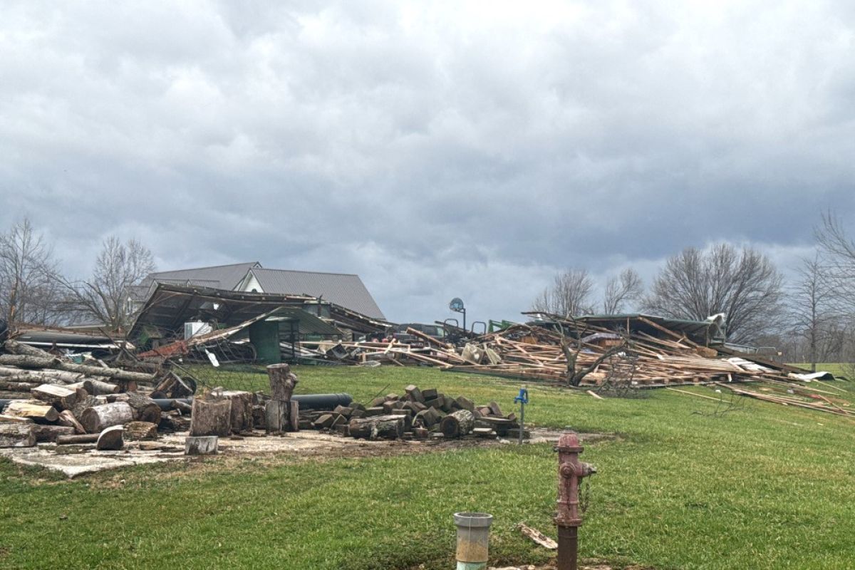
Rural building damage in Pike County from the March 15 EF-1 tornado.
(NWS Paducah)
There were 10 tornado reports in Indiana on March 14 and 15, according to preliminary data from the National Weather Service’s storm prediction center.
All reports were EF-0 or EF-1, which means weak to moderate tornadoes There are no reported deaths. Nationally, the Associated Press reported storms killed at least 39 people over the weekend.
Thunderstorm winds blew over a security trailer around 6 a.m. in Rushville, injuring three people, emergency management reported to the Indianapolis NWS Saturday.
There were four people injured after temporary structures were knocked over at a construction site around 7:30 a.m. Saturday in Clark County.
The Indianapolis NWS identified three tornadoes on the morning of March 15 in Parke, Jackson and Daviess Counties, and more than 10,000 people lost power.
“The first one was in Parke County, just west of Mecca," said Cody Moore, a meteorologist at the National Weather Service office in Indianapolis. "That was an EF1, with 110 mile-an-hour winds. Path length around 2.6 miles.”
The tornado travelled mainly through rural woods and farmland. A small garage was destroyed, and a 150-year-old barn was mostly destroyed, NWS reported.
So far, we have 3 tornadoes in central Indiana for March 15. Information on the EF-1 in Parke County and the EF-1 in Daviess County has been sent in Public Information Statements. We also working on a preliminary EF-1 tornado in Jackson County. More info later. #inwx
Moore said that tornadoes caused damage in Daviess and Jackson counties.
“There was a mobile home that was extensively damaged” in Jackson County, while the one that landed in Daviess County damaged buildings on a farm, he said.
“The farm sustained damage consistent with an EF1 tornado, with winds over 100 (miles per hour). Several metal farm outbuildings were damaged, as well,” he said.
The one in Daviess County had a path length of 13.6 miles, he said.
The Indianapolis division of the National Weather Service confirmed Monday two additional tornadoes from last Saturday in Lawrence County. Both were EF-0, or weak tornadoes.
The first began around 5 a.m. north of Fayetteville, causing minor barn roof damage and destroying an old shed. It moved about 2.2 miles north with peak winds at 75 mph.
The second started just after 5 a.m. in Marshall Township. It travelled for nearly a mile with estimated peak winds around 85 miles per hour. Damage reports said a shed was destroyed, and a porch was significantly damaged.
The Louisville NWS identified a tornado in Orange County. It travelled 11 miles in approximately eight minutes, NWS said, causing extensive tree damage and occasional structural damage.
Mike Kochasic is a meteorologist with the Louisville NWS.
"When you have a long line of thunderstorms moving into an area, typically you see little weak tornadoes, and you know an EF1 is on the weaker side, but, you know, 110 miles per hour, that's still a lot of wind, and being on the ground that long is is pretty impressive," he said.
We conducted a storm survey in Orange County, IN today, for the storms that occurred during the early morning of 3/15/2025. We found an EF-1 tornado occurred near West Baden Springs and continued for 11 miles to Orleans with a maximum wind speed of 110 mph. pic.twitter.com/TjCfhywS5L
The Paducah, Kentucky NWS identified an EF-1 in Pike County that damaged power poles and several homes. It also identified intermittent damage potentially caused by a tornado in Gibson County.
The Chicago NWS identified two tornadoes in Lake County: An EF-1 in Cedar Lake and an EF-0 in Schererville and Merrillville.
The Northern Indiana NWS identified a tornado on March 14 that travelled from Adams County into Ohio.
Forecasts are reporting rain and snow Wednesday night into Thursday, but no more severe weather is expected this week.