Numerous damage reports are coming in after widespread severe weather pushed through south central Indiana Friday night.
Severe Thunderstorm Warning continues for Ellettsville IN, Spencer IN and Morgantown IN until 9:15 PM EDT pic.twitter.com/z1w4d4J7rU
— NWS Indianapolis (@NWSIndianapolis) May 17, 2025
Weather spotters reported funnel clouds, hail up to 1.5 inches, and dangerous tornadoes on the ground throughout the evening.
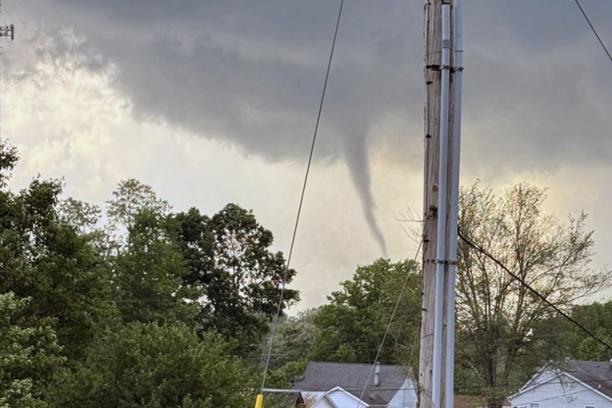
Tornado Warning continues for Bloomington IN, Smithville IN and Clear Creek IN until 7:45 PM EDT pic.twitter.com/hPC2dkpDpd
— NWS Indianapolis (@NWSIndianapolis) May 16, 2025
Clear Creek area was hit with telephone lines and trees downed, and severe house damage. The Clear Creek Post Office is destroyed.
Monroe county is under a travel advisory meaning routine travel or activities may be restricted due to a hazardous situation.
Duke Energy is reporting more than 27,000 customers without power including 2,600 in Monroe County, 10,000 in Hamilton County and 2,600 in Greene County.
Tornado damage on That Road, close to south Kroger location in Clear Creek. (Courtesy Preston Hubbard)
WFIU/WTIU News has reporters on the scene. This post will be updated.
6:45 P.M. UPDATE
Warnings are in effect throughout south central Indiana. Rotation is being detected on radar triggering tornado warnings for Sullivan and Greene counties.
Numerous thunderstorm warnings are in effect due to softball size hail and 70 MPH wind gusts. Storms are moving east at about 45 MPH.
Destructive storms are passing through the state - take precaution and stay with local media for further alerts.
Tornado Warning including Linton IN, Sullivan IN and Dugger IN until 7:00 PM EDT pic.twitter.com/SyIptGgLSy
— NWS Indianapolis (@NWSIndianapolis) May 16, 2025
4:00 P.M. UPDATE
Forecasters are calling for widespread damaging winds of more than 80 mph this afternoon into the evening.
The National Weather Service is predicting severe storms especially for locations along and south of a line from Sullivan to Bloomington to Columbus.
A tornado watch is in effect until 11 p.m.
Damaging straight line winds, tornadoes, large hail, heavy rain, and lighting are also possible.
Storms are expected to move to the east-northeast starting around 5 p.m. and ending around 10 p.m.
Daytime temperatures could reach 85 degrees Friday, with weekend highs in the mid 80s.
Later today we have a chance for widespread strong winds and a lot of folks will be out and about in their RV for various reasons. Exercise extra caution today! #INwxhttps://t.co/khmc7ItmS6
— NWS Indianapolis (@NWSIndianapolis) May 16, 2025